Professional Drone Services of Texas Highlights Aerial Imaging Capabilities

Logo - Drone Services tx
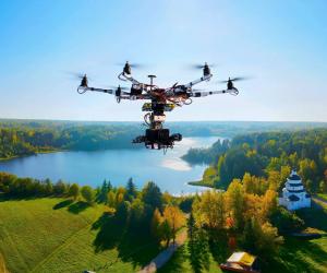
Professional Drone Services of Texas showcases expert aerial imaging solutions, offering high-quality visuals for various industries and applications.
HOUSTON, TX, UNITED STATES, June 27, 2025 /EINPresswire.com/ -- Professional Drone Services of Texas draws attention to the expanding role of aerial photography in Texas industries. Aerial imaging helps document job sites, monitor land changes, and support planning tasks across a variety of fields.For example, aerial photos help track project progress or identify patterns not visible from the ground. These images also support recordkeeping and compliance across sectors.
Drone Aerial Services in Real-World Applications
Drone aerial services go beyond photography. They help collect data, monitor safety, and assist with remote site access.
These services are used in:
• Real estate and property marketing
• Land and crop surveying
• Utility line inspection
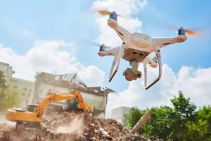
• Site documentation during construction phases
Next, using drones makes it easier to reach areas that are hard to access, which improves both speed and safety.
Drone Aerial Inspections: A Practical Approach
Drone aerial inspections provide an efficient way to examine roofs, towers, or infrastructure without physical contact. This method allows for early detection of damage, wear, or structural problems.
In addition, drones support regular inspection cycles. Teams can track site conditions over time and compare changes without repeat site visits.
A Houston Aerial Photography Company Meeting Regional Needs
Located in Houston, Professional Drone Services of Texas works with clients across the city and nearby regions. Projects range from short-term assignments to long-term monitoring of multi-phase developments.
This Houston Aerial Photography Company works with industries such as: engineering and public works, commercial development, and environmental research.
Work is scheduled based on location, weather, and project goals.
Drone Equipment and Imaging Standards
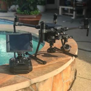
The drones in use are equipped with GPS-guided systems and 4K cameras. This ensures image clarity and consistency, especially when documenting the same site across different dates.
These features include:
• Smooth, stabilized video capture
• High-resolution still photos
• Pre-programmed flight paths for repeat imaging
Each flight is conducted in compliance with FAA regulations for airspace and safety.
Operator’s Role in Delivering Clear, Unaltered Imagery
The operator behind the drone controls each flight with attention to detail. Her focus remains on capturing scenes as they are, without filters or visual effects.
Her work aims to document real-time conditions, deliver usable images for planning and reporting, and avoid stylized or edited visuals
This approach keeps the output practical and dependable.
Responding to Local Demand for Drone Service Near You
As demand increases for ""drone service near you,"" especially in growing cities like Houston, these services offer a practical solution. Drone flights help survey land, map property boundaries, and assess site safety.
Clients benefit from:
• Fast data collection
• Reduced physical risk during inspections
• Images ready for use in reports or permits
In addition, visuals can be archived and compared over time, aiding future decisions.
Evolving Role of Drone Aerial Photography Services
Drone aerial photography is becoming part of regular operations for many organizations. The speed, reach, and accuracy of drone imaging support decision-making and reduce the need for repeated site visits.
This shift is seen in sectors like:
• Urban development
• Infrastructure maintenance
• Disaster response documentation
Next, as drone use expands, it may become a standard tool in large-scale project planning.
Mapping Services Expand with New Pilot in Dallas
Professional Drone Services of Texas expands its presence in North Texas with the addition of a new pilot based in Dallas. This development strengthens the company’s capacity to deliver detailed mapping and imaging services in that region.
The Dallas-based pilot brings experience in:
• Topographic mapping for construction and planning
• Site modeling and elevation data collection
• Orthomosaic imagery used for land assessment
This expansion supports the growing demand for aerial mapping in the Dallas area and allows for quicker response times and localized service coverage.
Conclusion
Professional Drone Services of Texas continues to provide structured, image-based support to professionals working across land, buildings, and infrastructure. Its aerial imaging helps document real-world conditions in a safe, efficient manner.
Drone aerial services offer accurate perspectives that assist with inspections, progress tracking, and recordkeeping. With clear and consistent visuals, these tools continue to grow in importance throughout Texas and beyond.
Professional Drone Services Of Texas
Professional Drone Services Of Texas
+1 (832) 856-8556
info@droneservicestx.com
Visit us on social media:
Facebook
Distribution channels: Technology
Legal Disclaimer:
EIN Presswire provides this news content "as is" without warranty of any kind. We do not accept any responsibility or liability for the accuracy, content, images, videos, licenses, completeness, legality, or reliability of the information contained in this article. If you have any complaints or copyright issues related to this article, kindly contact the author above.
Submit your press release


